
The European Space Agency (ESA) has launched the newest addition to its multi-billion-euro Copernicus program. The monitoring network aims to track pollution, deforestation, weather, and other changes on Earth's surface.
Sentinel 2 scans earth's vegetation
The Sentinel-2B satellite entered orbit on Tuesday after blasting off from ESA's launch site Kourou in French Guiana. Its twin, Sentinel-2A, was launched in 2015. Both of the satellites are a part of a fleet set up for ESA's Copernicus Earth Monitoring program, which is the world's largest environmental monitoring project, according to the agency.
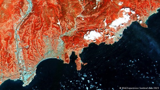
The two orbiters are set to monitor the globe from the opposite sides of the planet and send out high-resolution color and infrared images of the surface. By doing so, the satellites will help scientists track changes in forest cover and water pollution. The tandem's data will provide "unprecedented" views of the Earth, ESA said on their website.
"The pair of Sentinel-2 satellites will cover the Earth's entire surface in five days," launch firm Arianespace said last week.
"This high frequency means they will capture brand-new views of the Earth, driving considerable progress in monitoring and predicting changes in vegetation and aquatic pollution."
In addition to Sentinels-2A and 2B, the Copernicus Earth monitoring project includes two other Sentinel satellites equipped with cloud penetrating radar. The twins are designed to spot a wide range of phenomena, such as iceberg movement, but can also monitor oil slicks and illegal logging.
ESA is planning to launch more devices to focus on ocean data and Earth's atmosphere, eventually bringing the number of satelites to seven. The Copernicus program will also be able to send out data on areas hit by natural disasters, helping emergency teams estimate the damage and find operational lines, roads and bridges.
